Location Highlights
Dawson
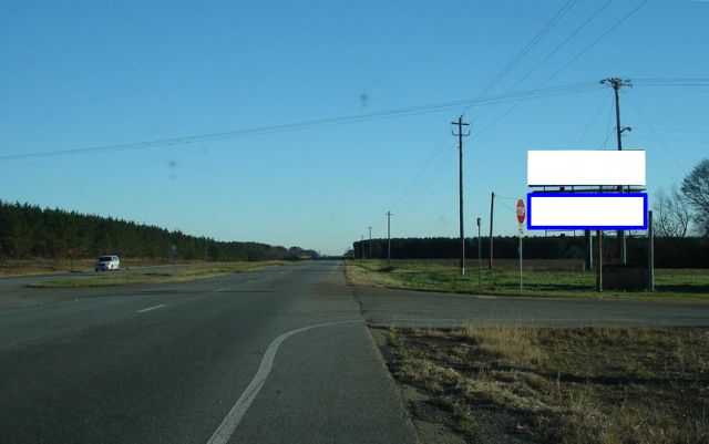
SR 520 Columbus Hwy 3 mi W/O Dawson City Limits, SS, EB RHR, W/F RR
Latitude/Longitude: 31.83504,-84.46706
Details
Illuminated Bulletin Approximate Size: 10'0 x 33'0
Weekly Circulation 18+: 31,416
Rural - Intersection SR520/Columbus Hwy and Hoods Store Road
This is the Bottom structure of a double-stacked right-hand read unit, reaching eastbound traffic on State Route 520 inbound to Dawson. State Route 520/Columbus Hwy is the major artery between Dawson and Columbus to the northwest, running through Cusseta, Richland, Weston and Parrott. Reaches locals/commuters, agriculture and business travelers, and military (Fort Benning South).